Collection
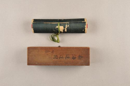
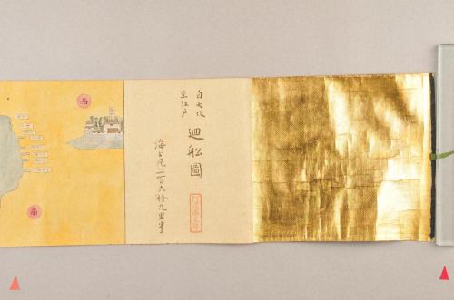
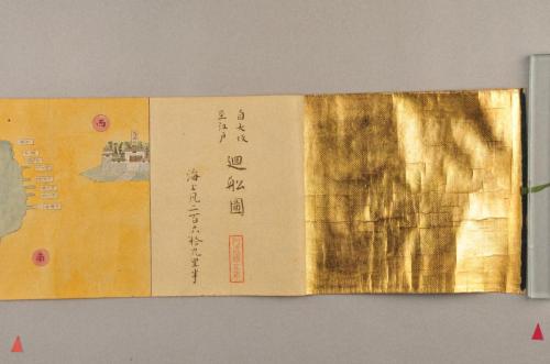
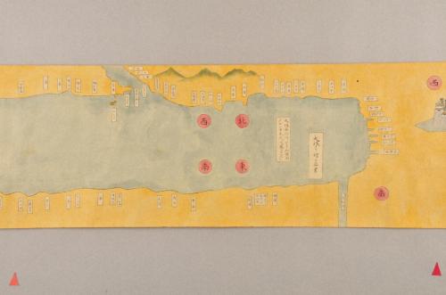
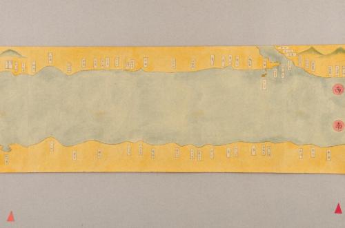
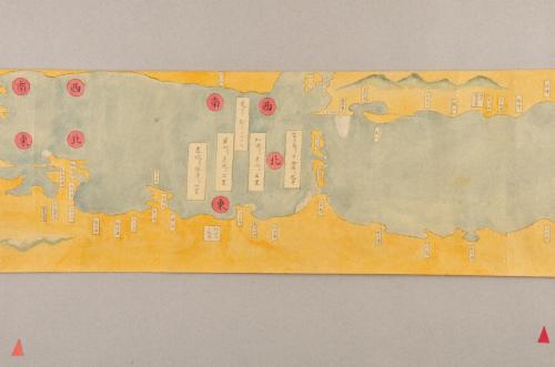
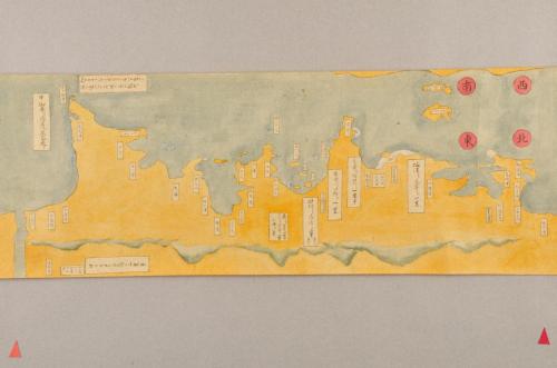
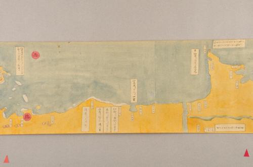
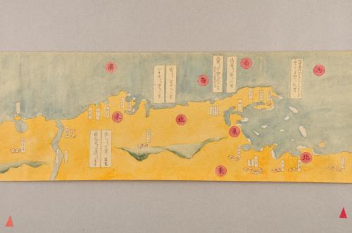
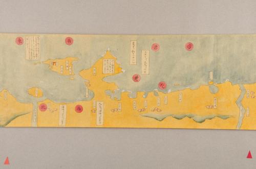
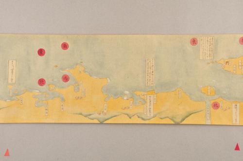
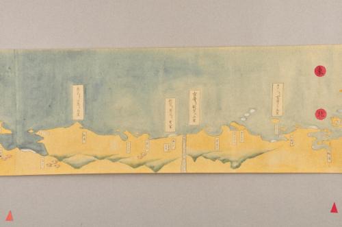
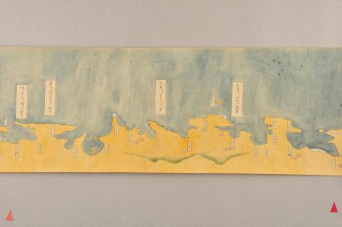
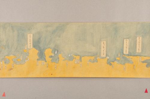
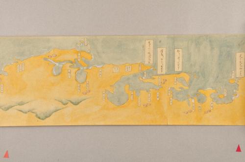
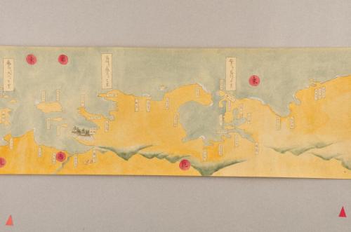
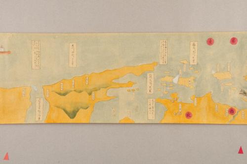
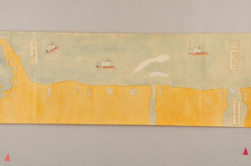
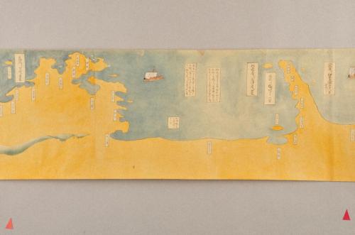
自大坂至江戸廻船図 おおさかよりえどにいたるかいせんず
Object Information
| Period | 江戸 |
|---|---|
| Material and Technique | 紙本木版墨刷 |
| Museum/ Collection Repository |
Wakayama Prefectural Museum |
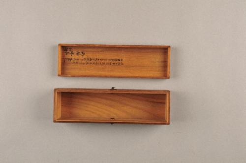
| Remarks | 紀伊半島を含め、大坂から江戸までを結ぶ廻船の航路を、陸地側から描いた海路図。大坂から江戸までの距離は海上約269里半とされ、主要地点ごとに小刻みに里程が記されている。海は青、陸は黄に彩色、陸地の山並みは緑で、人家や寺社も描かれているが限定的である。海上には里程だけでなく、廻船の運行に必要な情報(風・磯・浅瀬など)が各所に記されている。奥書により、安永2年(1773)に成立したものとわかる。阿波藩主・蜂須賀家の「阿波国文庫」印が、巻頭・巻末に捺されている。 |

About Image
Use and Downloading
This image is available for download. However, please check the usage rules of each museum under ‘About Image Use.’ When using the image, you must credit the museum name, and depending on the purpose, you may need to apply for permission. For high-resolution images, please contact the respective museum.
-
Image Download
- 1枚目 Public Domain Mark
- 2枚目 Public Domain Mark
- 3枚目 Public Domain Mark
- 4枚目 Public Domain Mark
- 5枚目 Public Domain Mark
- 6枚目 Public Domain Mark
- 7枚目 Public Domain Mark
- 8枚目 Public Domain Mark
- 9枚目 Public Domain Mark
- 10枚目 Public Domain Mark
- 11枚目 Public Domain Mark
- 12枚目 Public Domain Mark
- 13枚目 Public Domain Mark
- 14枚目 Public Domain Mark
- 15枚目 Public Domain Mark
- 16枚目 Public Domain Mark
- 17枚目 Public Domain Mark
- 18枚目 Public Domain Mark
- 19枚目 Public Domain Mark
- 20枚目 Public Domain Mark
- About Image Use


